Laurence Blackwell-Thale Yr5
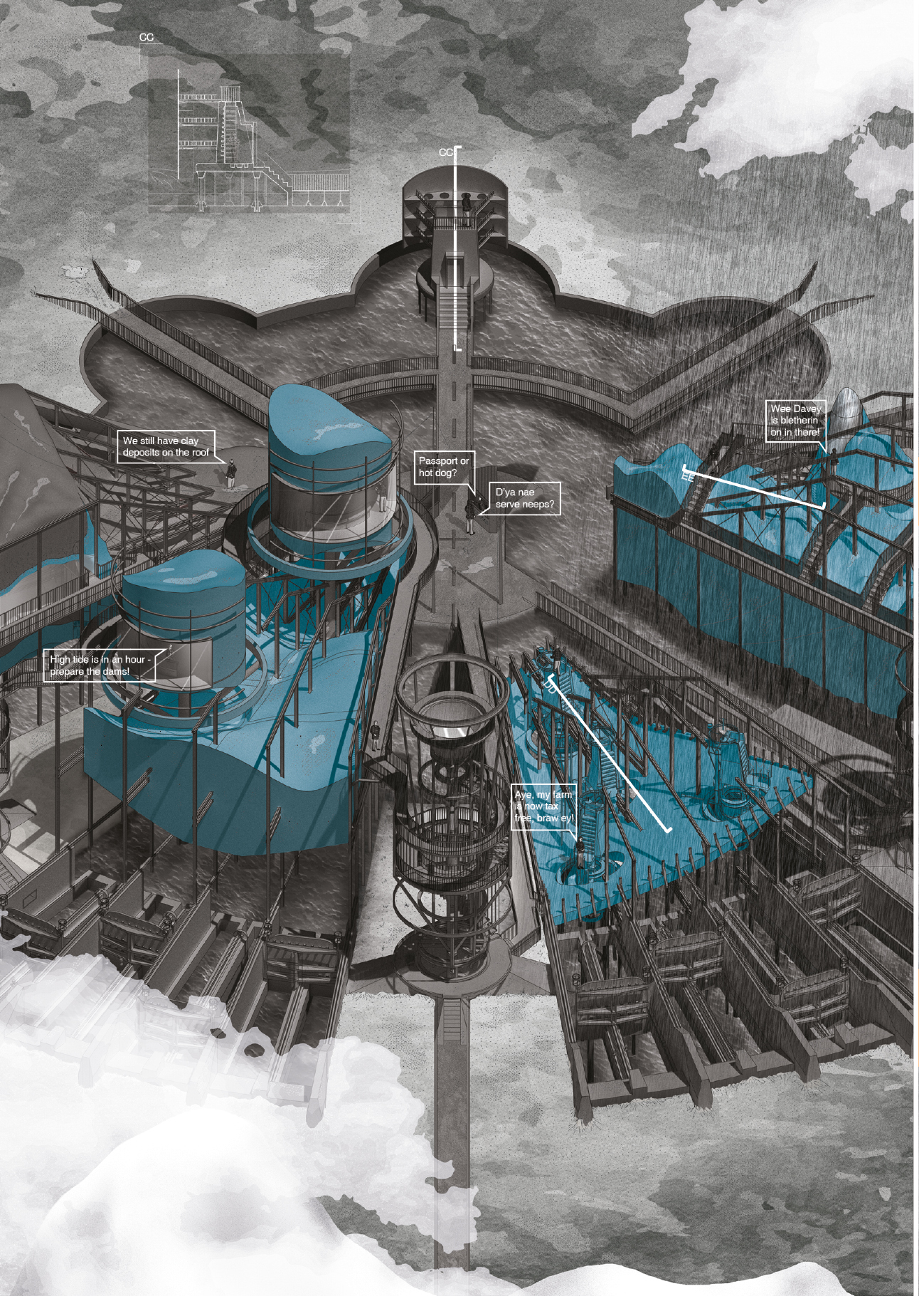
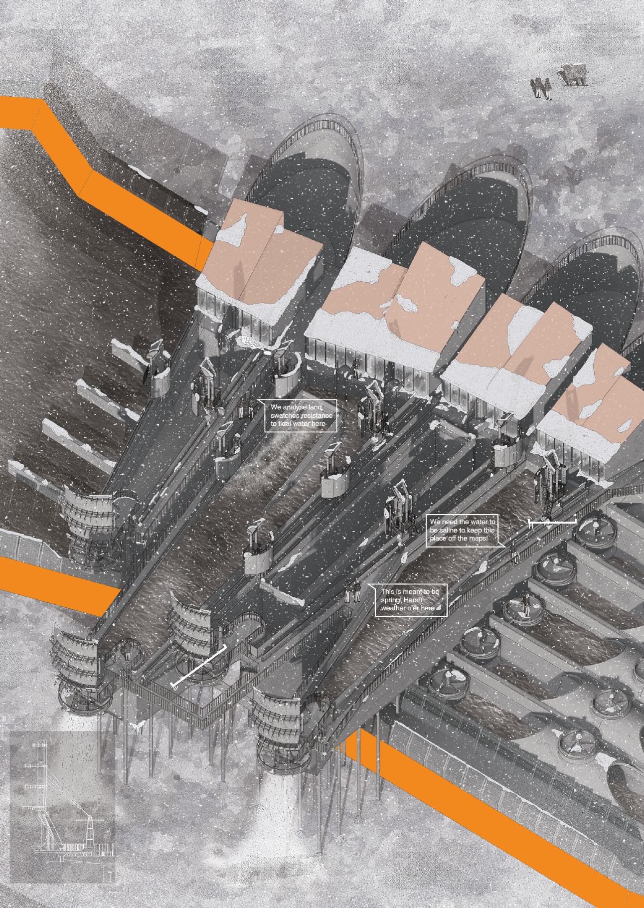
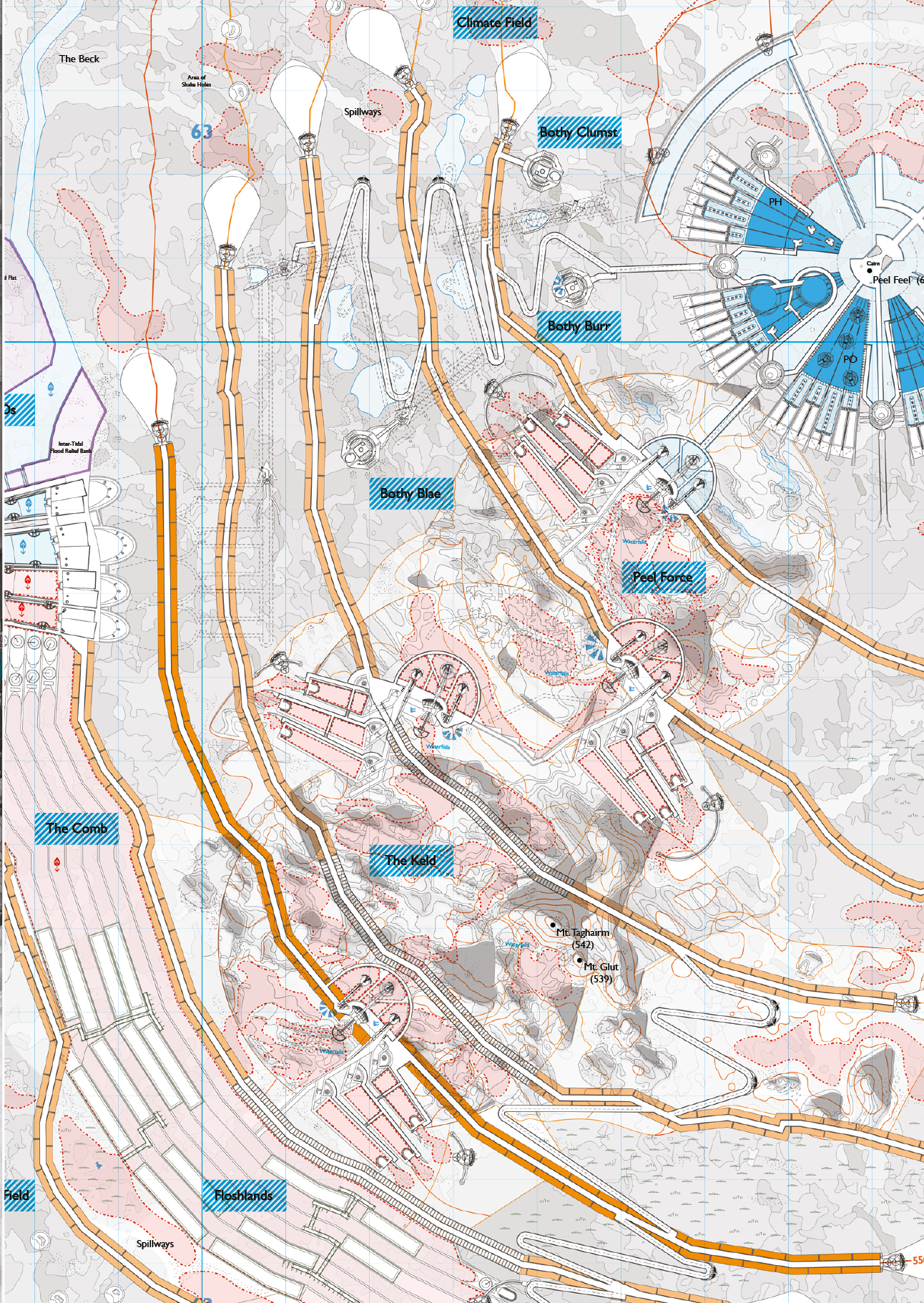
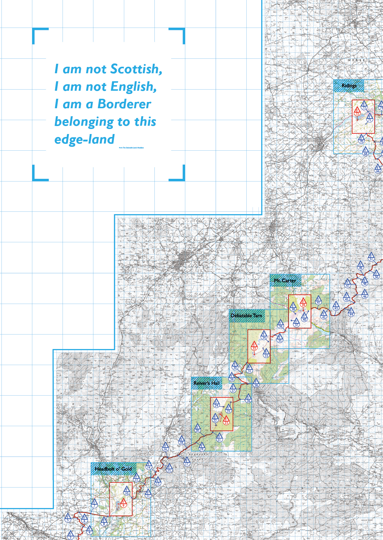
The Debatable Lands propose a new cooperative municipality on the Anglo-Scottish border. 96 forts and forlets, one for each mile of the border (mimicking the Roman settlements on Hadrian’s wall), use tidal water to blur a line that has caused cultural division for thousands of years. Borderers from the historic cross-border Marches join this tax-free cooperative and in return, they must work a portion of the year at one of the six main forts, travelling across the remote Anglo-Scottish terrain to ensure enough tidal salt maintains their Debatable Lands status. The 90 fortlets act as bothies associated with the Scottish ‘freedom to roam’ law. The six forts include a bank, a court, an energy production facility (the Debatable Tarn), a storage bank, a flood prevention centre and an education platform, all of which are large-scale and designed to appear and natural features when seen on an OS map.
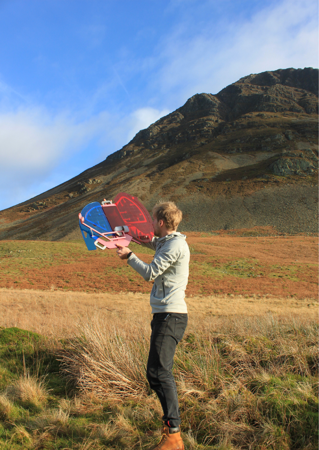
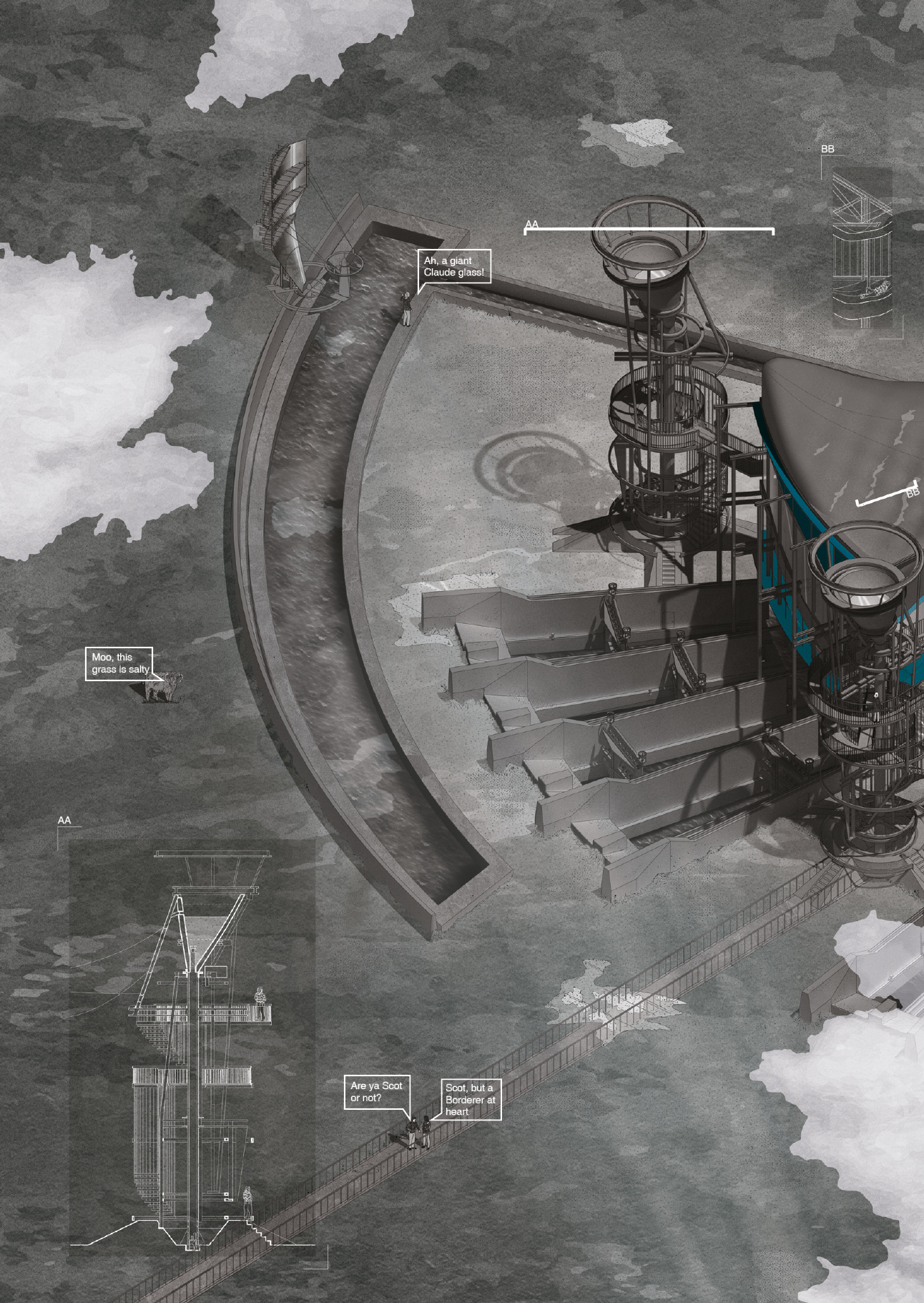
The design for the Debatable Tarn energy facility combines the infrastructure needed to mimic the natural tide with the notion of a ‘Kantian Sublime’ experience. The remote and harsh environment that surrounds the tarn induces the spectacular awe and terror that is the Sublime. Large Claude Glass reflectors create a tension between experiencing real nature and its reflection. Zooming in further, the cartographic understanding of the site is dually examined with the tarn’s ‘naturalness’. Should we accept that what is deemed natural on the British Isles is actually artificial and quantifiable, be it through a 1:50,000 OS map or the pine tree plantations in Kielder?
The Debatable Tarn revels in these questions, pre-empting its ruination and covering itself in entropic mud from its creation. The artificial looping tide weathers progress down the landscape until what could be delineated as natural land or build form are lost, along with the borderline, now permanently bleached red from the abundance of tidal salt, transferring the map onto the very land it represents.
